Weekend availability at Point Cedar
Live from Recreation.gov · checked Sep 18, 10:25 AM PT- Fri, Sep 18Open29/41 sites
- Fri, Sep 25Open28/41 sites
- Fri, Oct 2Open31/41 sites
- Fri, Oct 9Open30/41 sites
- Fri, Oct 16Open26/41 sites
- Fri, Oct 23Open28/41 sites
Friday + Saturday nights, sites bookable both nights. Counts come from a rotating sweep and can lag a cancellation by up to a day — alerts watch your exact dates within minutes.
Campsites & amenities
Site-level details from Recreation.gov's official catalog.
- Campsites
- 62
- Electric sites
- 42
- Water hookups
- 42
- Max rig length
- 76 ft
About this campground
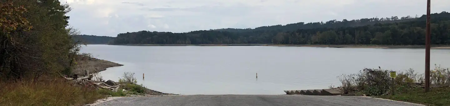
Overview Point Cedar Campground sits on the banks of DeGray Lake in the foothills of the Ouachita Mountains. World-class fishing and endless water sports make the campground a popular recreation area. Recreation Boating, water skiing, kayaking and other water sports are the biggest draw to the lake, and a boat ramp is provided. The lake is also stocked with a variety of game fish, including plenty of hybrid striped bass, making it an ideal area for both boat and bank fishing. Facilities Point Cedar provides reservable modern campsites with electric hookups and water at sites 1-42. Sites 43-62 are primitive sites. The campground comes with flush toilets, hot showers, potable water and a boat ramp. To see USACE DeGray Lake Virtual Tour, click here. Natural Features Degray Lake is one of the region's five Diamond Lakes, known for their crystal clear waters. The lake flows from the Caddo River in Western Arkansas and spans 13,500 surface acres. Nearby Attractions The DeGray Lake Resort State Park offers golf courses, tennis courts, horseback riding trails and more along the 207 miles of lake shoreline. The Ouachita National Forest and Hot Springs National Park are both located nearby.
Getting there
From Interstate 30, take exit 78 and merge onto State Highway 7 north to Bismarck. Turn left on State Highway 84 and go 9 miles west to Point Cedar. Turn left onto Shouse Ford road and continue 4 miles to the campground. Take the right turn at the T pointing to Point Cedar
Activities
- BOATING
- ACCESSIBLE SWIMMING
- CAMPING
- FISHING
- PHOTOGRAPHY
- WATER ACCESS
- WILDLIFE VIEWING
- PICNICKING
Never miss an opening at Point Cedar
Popular Arkansas campgrounds book out months ahead — but cancellations happen every day. We watch Point Cedar around the clock and alert you the moment a sold-out site reopens for your dates, so you don't have to keep refreshing Recreation.gov.
Not ready to subscribe? Get a free weekend heads-up.
We'll email you if Point Cedar opens up for a weekend you pick. No account needed.
Details from Recreation.gov's official RIDB catalog. Conditions change — confirm with the managing office or on Recreation.gov before you go. Not affiliated with Recreation.gov or any federal agency.